
Basics 4 min read

What are aviation charts?

Why charts exist, who publishes them, and why every serious sim pilot should learn to read them.

Aviation charts (often just "charts") are official documents that describe airports, airspace, and procedures in a standardized way. Real pilots cannot fly on instruments without them — and in Microsoft Flight Simulator they are the difference between guessing an approach and flying it properly.

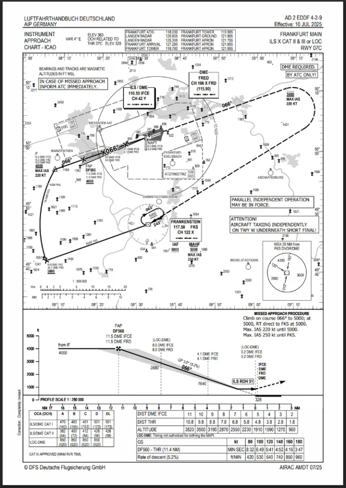
A real approach plate
This is one: the ILS approach plate for Frankfurt runway 07C, from the official German AIP. The same document a Lufthansa crew briefs from — you can explore it section by section in the Chart Explorer.

Who publishes charts?

Each country publishes an Aeronautical Information Publication ( ) containing all official charts. On top of that, commercial providers like (a Boeing company) re-render the same data in their own, very popular layout. That is why the same approach can look different depending on the source: the data is identical, the presentation is not.

Where sim pilots get charts

  • Charts — the most popular source in MSFS, Jeppesen-style plates, subscription-based, integrates with the in-sim .
  • — free flight planning; the paid Navigraph subscription adds real charts, but SimBrief alone gives you routes and altitudes.
  • Official AIPs — free for most countries (e.g. FAA charts for the USA, European AIPs via the national providers). Authentic but less beginner-friendly layout.
  • — free moving-map tool that displays navdata, procedures and frequencies, though not real plates.

The MSFS Guide compares these sources and walks through a complete flight workflow with them. Next up: chart types at a glance — which chart answers which question.